• Attractions
      • Back
      • Amusement Parks
      • Archaeology
      • Architecture
      • Art Galleries
      • Culture & Festivals
      • Forests & Jungles
      • Fortresses & Palaces
      • Hill-Tracts
      • Industries
      • Islands
      • Lakes
      • Land Ports
      • Libraries
      • Mountains
      • Movie Theaters
      • Museums
      • Parks & Zoos
      • Rivers
      • Sea Beaches
      • Stadiums
      • Tea States
      • Universities
      • Waterfalls
      • UNESCO World Heritage
  • Emergency & Services
      • Back
      • Airlines
      • Ambulance
      • Blood Banks
      • Fire Services
      • Foreign Missions
      • Hospitals
      • Police Stations
      • Security Services
      • Things To Avoid
      • Useful Words and Phrases
  • Blog
  • Agricultural Landuse
  • Agriculture Map
  • Agroecological Zones
  • Air Transport
  • Ancient Monuments
  • Archaeological Sites
  • Arsenic Contamination
  • Average Temperature
  • Bay of Bengal
  • Bio-Ecological Zones
  • Buddhist Vihara
  • Climate Map
  • Contour Map
  • Cropping Pattern
  • Cyclone Maps
  • Disaster Prone Areas
  • Earthquake Maps
  • Embankment Map
  • Flood Maps
  • Forests of Bangladesh
  • Forts in Bangladesh
  • Gas Blocks
  • Gas Fields & Gas Pipeline
  • General Soil Map
  • Geological Group Formation
  • Ground Water Zones
  • Historical Mosques
  • Land Ports
  • Landsat TM Image
  • Locations of Faults
  • Major Industries
  • Mineral Resources
  • Navigation Charts
  • Primary Power Grid System
  • Problem Soil Map
  • Railway Route Map
  • Rainfall Map
  • River Transport
  • Riverbank Erosion Map
  • Rivers of Bangladesh
  • Road Network
  • Rural House Pattern (1981)
  • Sectors of Liberation War
  • Soil Tracts
  • Tectonic Map
  • Wildlife Distribution

Landsat Satellite Image Mosaic: Bangladesh

  • Map-1
  • Map-2
  • Map-3
  • Map-4
  • Map-5
  • Info

Map-1

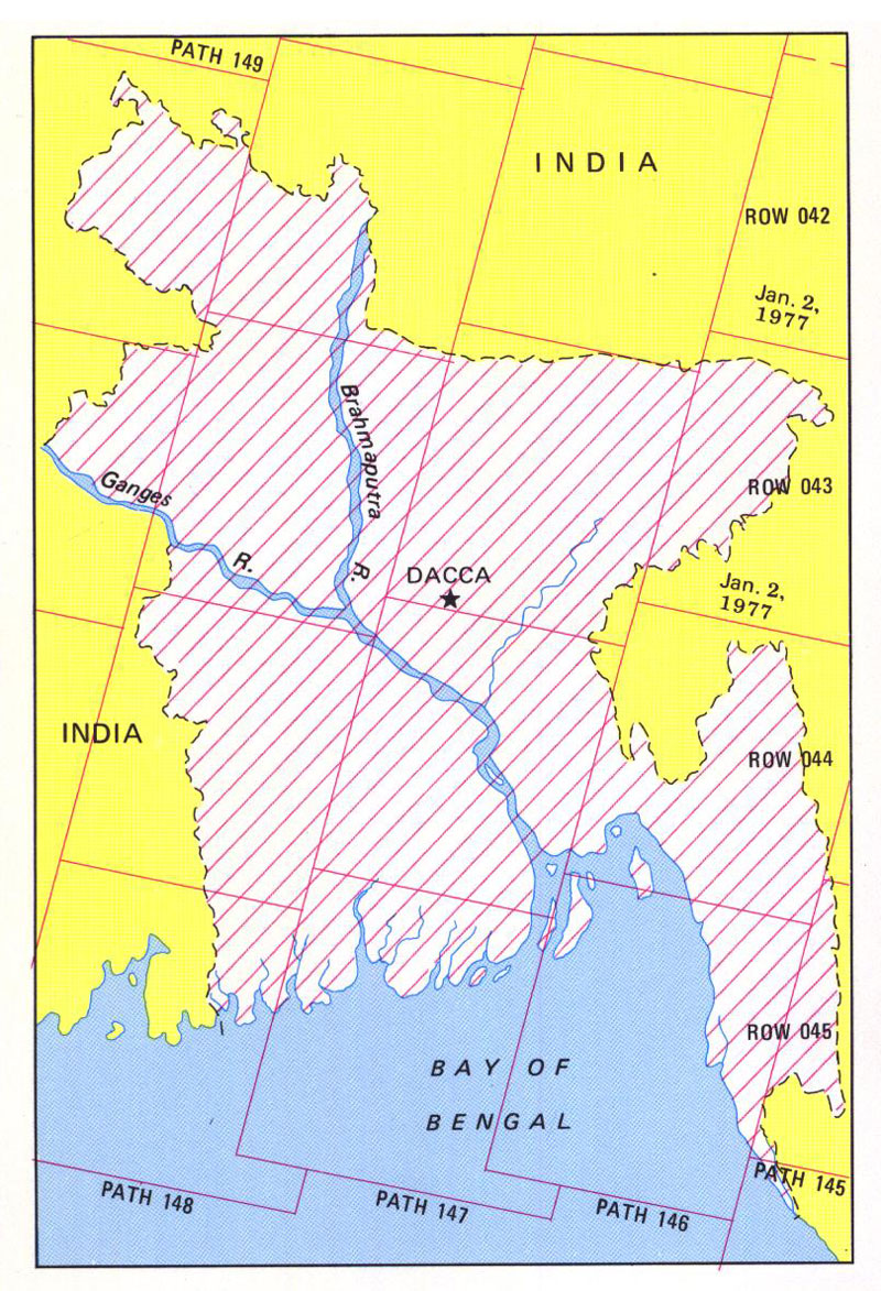
Landsat TM Image: Index Map

Landsat (TM) Satellite Digital Mosaic Image of Bangladesh

Map Courtesy: http://eusoils.jrc.ec.europa.eu/

Map-2

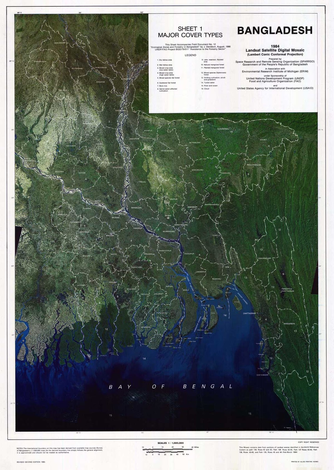
Landsat TM Image: Sheet 1 - Major Cover Types

Landsat (TM) Satellite Digital Mosaic Image of Bangladesh

Map Courtesy: http://eusoils.jrc.ec.europa.eu/

Map-3

Landsat TM Image: Sheet 2 - Land Zones & Land Systems

Landsat (TM) Satellite Digital Mosaic Image of Bangladesh

Map Courtesy: http://eusoils.jrc.ec.europa.eu/

Map-4

Landsat TM Image: Sheet 3 - Landuse Types

Landsat (TM) Satellite Digital Mosaic Image of Bangladesh

Map Courtesy: http://eusoils.jrc.ec.europa.eu/

Map-5

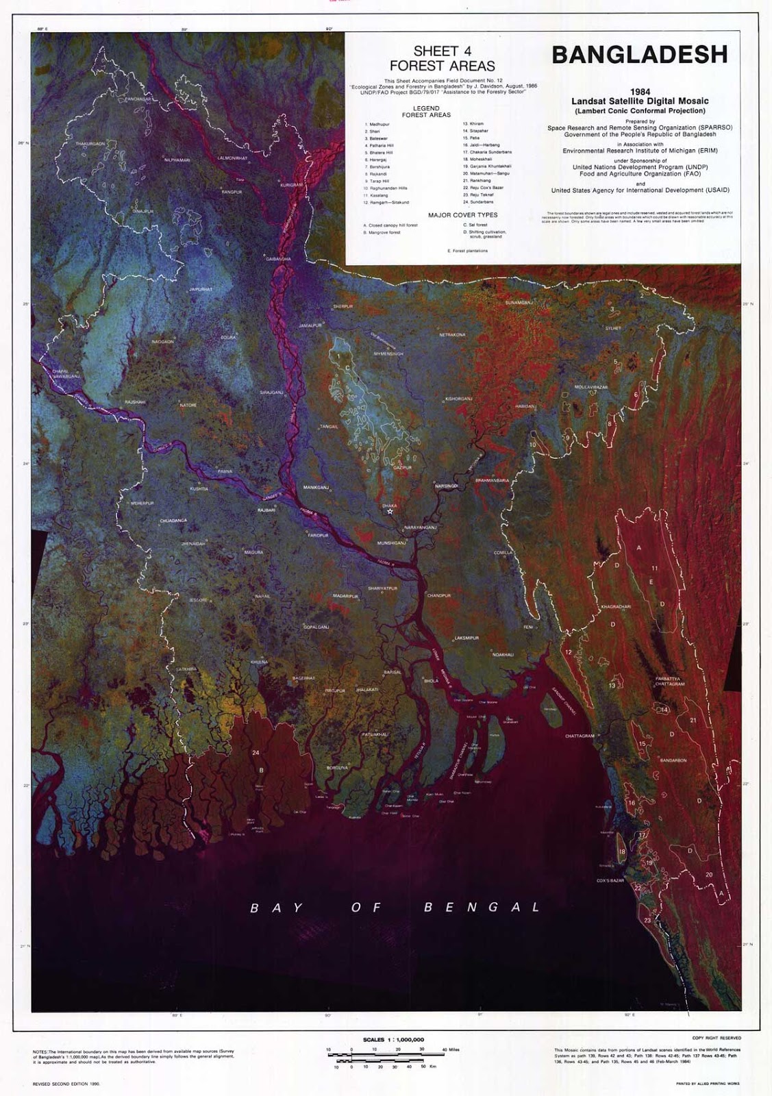
Landsat TM Image: Sheet 4 - Forest Areas

Landsat (TM) Satellite Digital Mosaic Image of Bangladesh

Map Courtesy: http://eusoils.jrc.ec.europa.eu/

Info

Landsat sensors record reflected and emitted energy from Earth in various wavelengths of the electromagnetic spectrum.  The electromagnetic spectrum includes all forms of radiated energy from tiny gamma rays and x-rays all the way to huge radio waves.  The human eye is sensitive to the visible wavelenghs of this spectrum; we can see color, or reflected light, ranging from violet to red.

Today, Landsats 7 and 8 “see” and record blue, green, and red light in the visible spectrum as well as near-infrared, mid-infrared, and thermal-infrared light that human eyes cannot perceive (although we can feel the thermal-infrared as heat).  Landsat records this information digitally and it is downlinked to ground stations, processed, and stored in a data archive.

It is this digital information that makes remotely sensed data invaluable. “Observations from Landsat are now used in almost every environmental discipline,” explains John Barker, a Landsat 7 Associate Project Scientist and award-wining calibration expert.

Landsat data have been used to monitor water quality, glacier recession, sea ice movement, invasive species encroachment, coral reef health, land use change, deforestation rates and population growth.    Landsat has also helped to assess damage from natural disasters such as fires, floods, and tsunamis, and subsequently, plan disaster relief and flood control programs.

Source: Landsat Science

Details
Last Updated: 06 September 2017
© The Bangladesh Network 2014 - 2025
Tourism Directory of BANGLADESH.
  • About
  • Contact
  • License
  • Privacy Policy
  • Terms of Use
Back to top