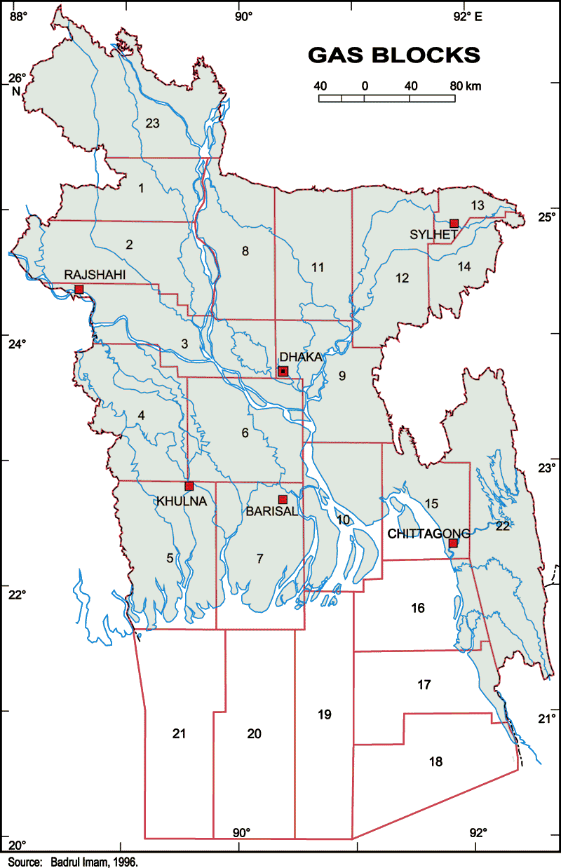
Map-2

Map Courtesy: Petrobangla
Review of the Acreage Block Map - 1989
No. of Blocks: 23
No. of Onshore Blocks: 17
No. of Offshore Blocks: 6
Average Size: 11,000 sq. km
Southern boundary of blocks were upto 20 degree North Latitude.
During 1st & 2nd bidding rounds total 10 PSCs were signed for 12 Blocks
Currently 8 PSCs are active in 10 Blocks.
Due to large size of the blocks, none of these blocks were fully explored.
Map-3
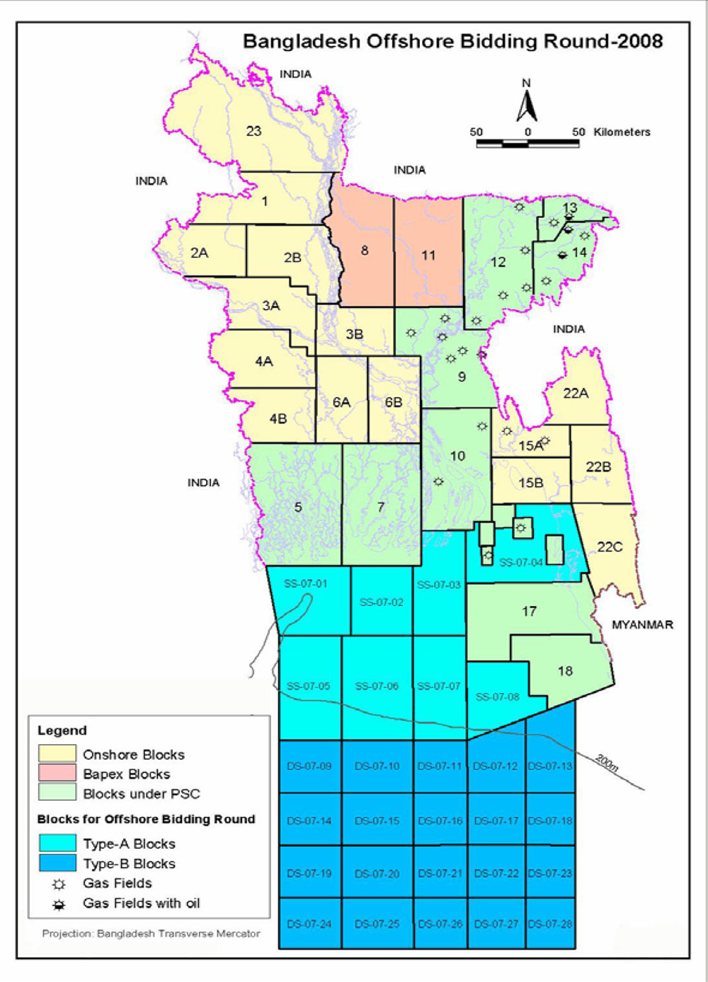
Map Courtesy: Petrobangla
The Acreage Block Map - 2008
Number of blocks on offer: 28 offshore blocks
The shallow water blocks situated north of 20o N latitude are categorized as Type-A.
The deep water blocks situated south of 20o N latitude are categorized as Type-B.
Type A:
Average Size: 6,000 sq. km
No. of Blocks: 8
Max Water Depth: about 200 m
Type B:
Average Size: 3,300 sq. km
No. of Blocks: 20
Max Water Depth: about 2,000 m