• Attractions
      • Back
      • Amusement Parks
      • Archaeology
      • Architecture
      • Art Galleries
      • Culture & Festivals
      • Forests & Jungles
      • Fortresses & Palaces
      • Hill-Tracts
      • Industries
      • Islands
      • Lakes
      • Land Ports
      • Libraries
      • Mountains
      • Movie Theaters
      • Museums
      • Parks & Zoos
      • Rivers
      • Sea Beaches
      • Stadiums
      • Tea States
      • Universities
      • Waterfalls
      • UNESCO World Heritage
  • Emergency & Services
      • Back
      • Airlines
      • Ambulance
      • Blood Banks
      • Fire Services
      • Foreign Missions
      • Hospitals
      • Police Stations
      • Security Services
      • Things To Avoid
      • Useful Words and Phrases

Thakurgaon District

  • Maps
  • Basic Info
  • GoogleMap
  • RESOURCES

Maps

Thakurgaon District Map Bangladesh

Map of Thakurgaon District. Map Courtesy: Banglapedia

Thakurgaon District Map Bangladesh

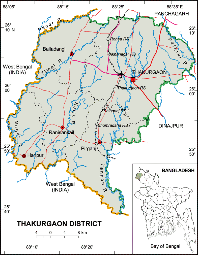
Map of Thakurgaon District. Map Courtesy: LGED Bangladesh

Basic Info

Basic Information

Thakurgaon District (Rangpur division) with an area of 1,809.52 sq km, is bounded by panchagarh district on the north, west bengal of India on the west and south, Panchagarh and dinajpur districts on the east. Annual average temperature: maximum 33.5 oC, minimum 10.5 oC; annual rainfall 2536 mm. Main rivers are tangon, punarbhaba, nagar, Pathari, Talma, Kulic, dhepa.

At a Glance

Area: 1,809.52 Km2
Upazila Road: 492.54 Km
Union Road: 776.92 Km
Village Road: 1697.06 Km VA
1705.83 Km VB
Population: 12,95,522 (2001)
Density: 751 per Km2
Literacy: 65 %
Upazilas: 5
Union: 51
Pourashavas: 3
Primary Schools: 954
High Schools: 279
Colleges: 45

GoogleMap

Reduce


RESOURCES

  • KML file for Thakurgaon District: Download
Details
Last Updated: 03 March 2018
© The Bangladesh Network 2014 - 2026
Tourism Directory of BANGLADESH.
  • About
  • Contact
  • License
  • Privacy Policy
  • Terms of Use
Back to top