• Attractions
      • Back
      • Amusement Parks
      • Archaeology
      • Architecture
      • Art Galleries
      • Culture & Festivals
      • Forests & Jungles
      • Fortresses & Palaces
      • Hill-Tracts
      • Industries
      • Islands
      • Lakes
      • Land Ports
      • Libraries
      • Mountains
      • Movie Theaters
      • Museums
      • Parks & Zoos
      • Rivers
      • Sea Beaches
      • Stadiums
      • Tea States
      • Universities
      • Waterfalls
      • UNESCO World Heritage
  • Emergency & Services
      • Back
      • Airlines
      • Ambulance
      • Blood Banks
      • Fire Services
      • Foreign Missions
      • Hospitals
      • Police Stations
      • Security Services
      • Things To Avoid
      • Useful Words and Phrases

Shariatpur District

  • Maps
  • Basic Info
  • GoogleMap
  • RESOURCES

Maps

Shariatpur District Map Bangladesh

Map of Shariatpur District. Map Courtesy: Banglapedia

Shariatpur District Map Bangladesh

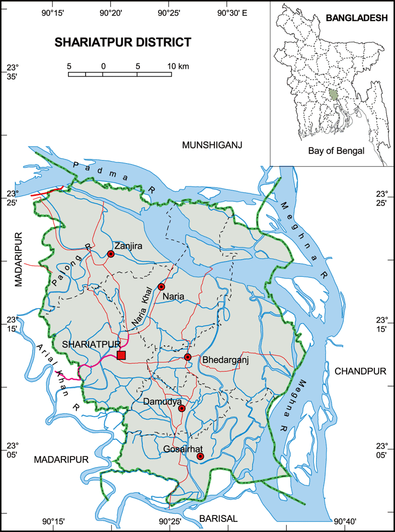
Map of Shariatpur District. Map Courtesy: LGED Bangladesh

Basic Info

Basic Information

Shariatpur District (Dhaka division) with an area of 1,181.53 sq km, is bounded by munshiganj district on the north, barisal district on the south, chandpur district on the east, madaripur district on the west. Annual average temperature: highest 35.8 oC and lowest 12.6 oC; annual rainfall 2105 mm. Main rivers are Padma, Meghna, Palong and Kirtinasha.

At a Glance

Area: 1,181.53 Km2
Upazila Road: 295.60 Km
Union Road: 487.75 Km
Village Road: 830.98 Km VA
998.67 Km VB
Population: 5,38,462
Density: 488 per Km2
Literacy: 38.29 %
Upazilas: 6
Union: 64
Pourashavas: 5
Primary Schools: 631
High Schools: 125
Colleges: 17

GoogleMap

Reduce


RESOURCES

  • KML file for Shariatpur District: Download
Details
Last Updated: 03 March 2018
© The Bangladesh Network 2014 - 2026
Tourism Directory of BANGLADESH.
  • About
  • Contact
  • License
  • Privacy Policy
  • Terms of Use
Back to top