
Maps
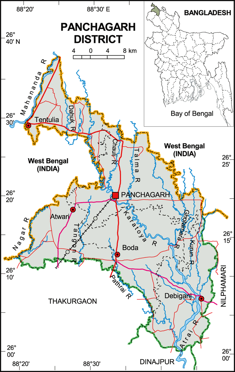
Map of Panchagarh District. Map Courtesy: Banglapedia
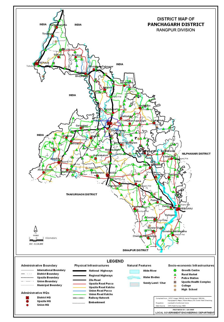
Map of Panchagarh District. Map Courtesy: LGED Bangladesh
Basic Info
Basic Information |
| Panchagarh District (Rangpurdivision) extreme northern district of Bangladesh with an area of 1,404.63 sq km is bounded on three sides by 288 km long Indian border, having Darjeeling district on the north, Jalpaiguri and Kuchbihar districts on the northeast, West Dinajpur and Purnea district on the west, dinajpur and thakurgaon districts on the south, nilphamari district on the east. Its soil is sandy, alluvial and bears close affinity with the soil of the old Himalayan basin. On the northern part of the district there exists underground layer of pebbles. Maximum temperature 30.2 oC and minimum 10.1 oC; annual total rainfall 2931 mm. Main rivers are Karatoya, Atrai, Tista, Mahananda, Tangon, Dahuk, Pathraj, Bhulli, Talma, Nagar, Chawai, Kurum, Versa, Tirnoi, Chilka. |
At a Glance |
|
| Area: | 1,404.63 Km2 |
| Upazila Road: | 429.38 Km |
| Union Road: | 591.50 Km |
| Village Road: | 870.47 Km VA |
| 1491.70 Km VB | |
| Population: | 9,79,126 (2009) |
| Density: | 641 per Km2 |
| Literacy: | 43.70 % |
| Upazilas: | 5 |
| Union: | 43 |
| Pourashavas: | 2 |
| Primary Schools: | 599 |
| High Schools: | 194 |
| Colleges: | 22 |
- Details