Maps

Map of Bogra District. Map Courtesy: Banglapedia
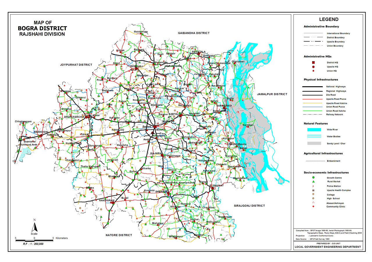
Map of Bogra District. Map Courtesy: LGED Bangladesh
Basic Info
Basic Information |
| Bogra District (Rajshahi division) with an area of 2,919.9 sq km, bounded by joypurhat and gaibandha districts on the north, the chalan beel, natore and sirajganj districts on the south, jamuna river and jamalpur district on the east, Part of Chalan Beel, naogaon and Natore districts on the west. Main rivers: karatoya, nagar, Bangali, ichamati. Notable Beels are Betgari, Kaigari, Subeel, Nuruler Beel, Poradaha Beel, Keshpathar, Kalidaha, Padma, Sattarail, Garai, Arulia Demradaha, Sara, Gobarchapa, Mahichbaran, Ziadaha, Ramchandrapur, Kokira, Bahuar Beel, Kachiar Beel. Adamdighi, Sangshar, Badla, Sil Kawrer Dighi, Shahar Dighi, Kuldighi, Khadash Dighi are also notable water bodies. Annual average temperature maximum 34.6 oC and minimum 11.9 oC; annual total rainfall 1610 mm. |
At a Glance |
|
| Area: | 2,919.9 Km2 |
| Upazila Road: | 113.98 Km |
| Union Road: | 1207.25 Km |
| Village Road: | 1812 Km VA |
| 1272.24 Km VB | |
| Population: | 15,42,475 (2001) |
| Density: | 527 per Km2 |
| Literacy: | 50% |
| Upazilas: | 12 |
| Union: | 108 |
| Pourashavas: | 10 |
| Primary Schools: | 1345 |
| High Schools: | 591 |
| Colleges: | 30 |
- Details