Atghar Kuriana Union, Pirojpur
Atghar Kuriana is a union under Nesarabad (swarupkati) Upazila of Pirojpur District with a total area of 19.558 square kilometers. The total population of the union is 18,391 among them 9,452 are male and 8,939 are female.
Map of Atghar Kuriana of Pirojpur District.
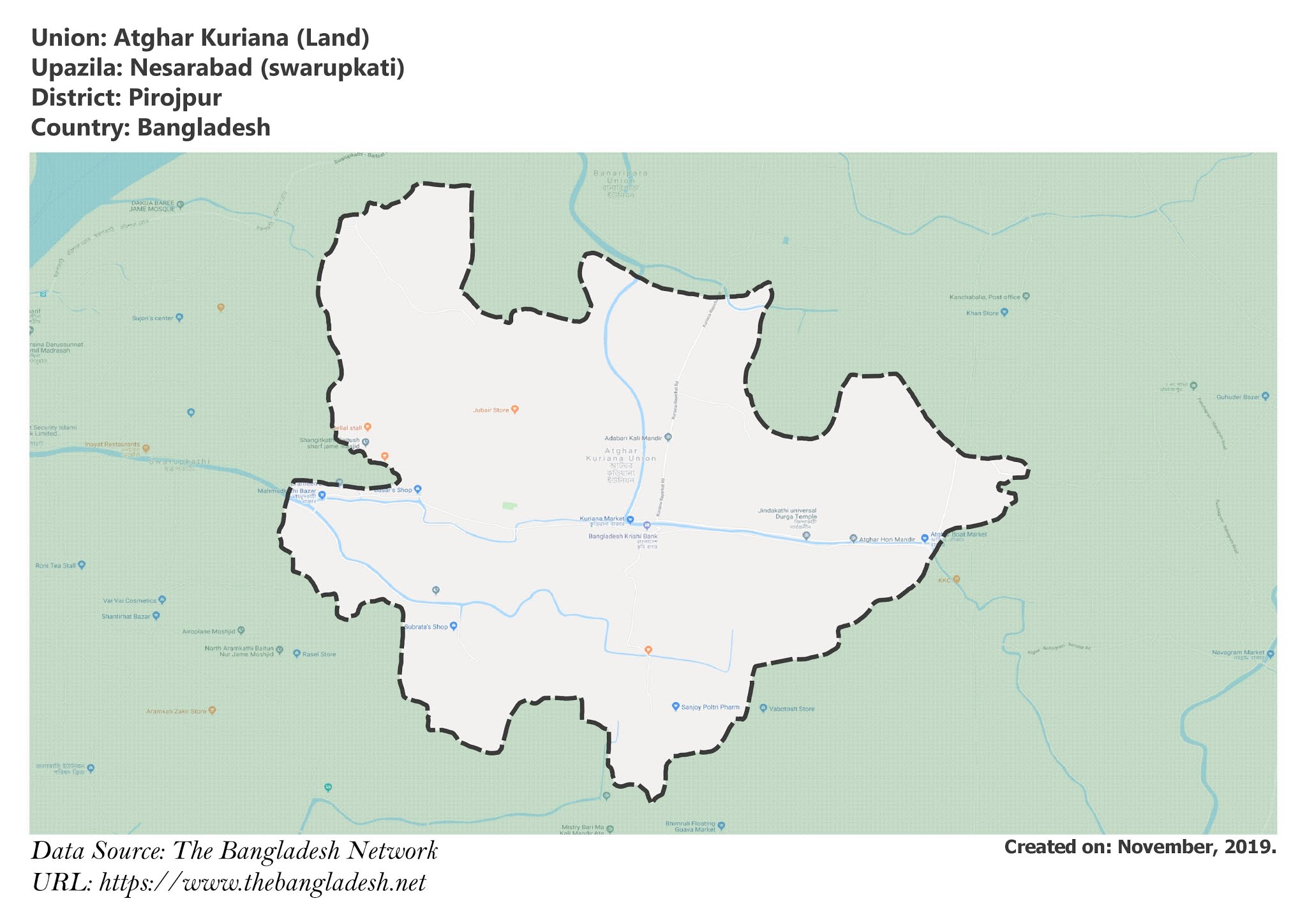
Map of Atghar Kuriana of Nesarabad (swarupkati) Upazila.
Map Courtesy: The Bangladesh Network.
- Details
- Written by Mahamudul Hasan
Baldia Union, Pirojpur
Baldia is a union under Nesarabad (swarupkati) Upazila of Pirojpur District with a total area of 20.999 square kilometers. The total population of the union is 32,083 among them 15,985 are male and 16,098 are female.
Map of Baldia of Pirojpur District.
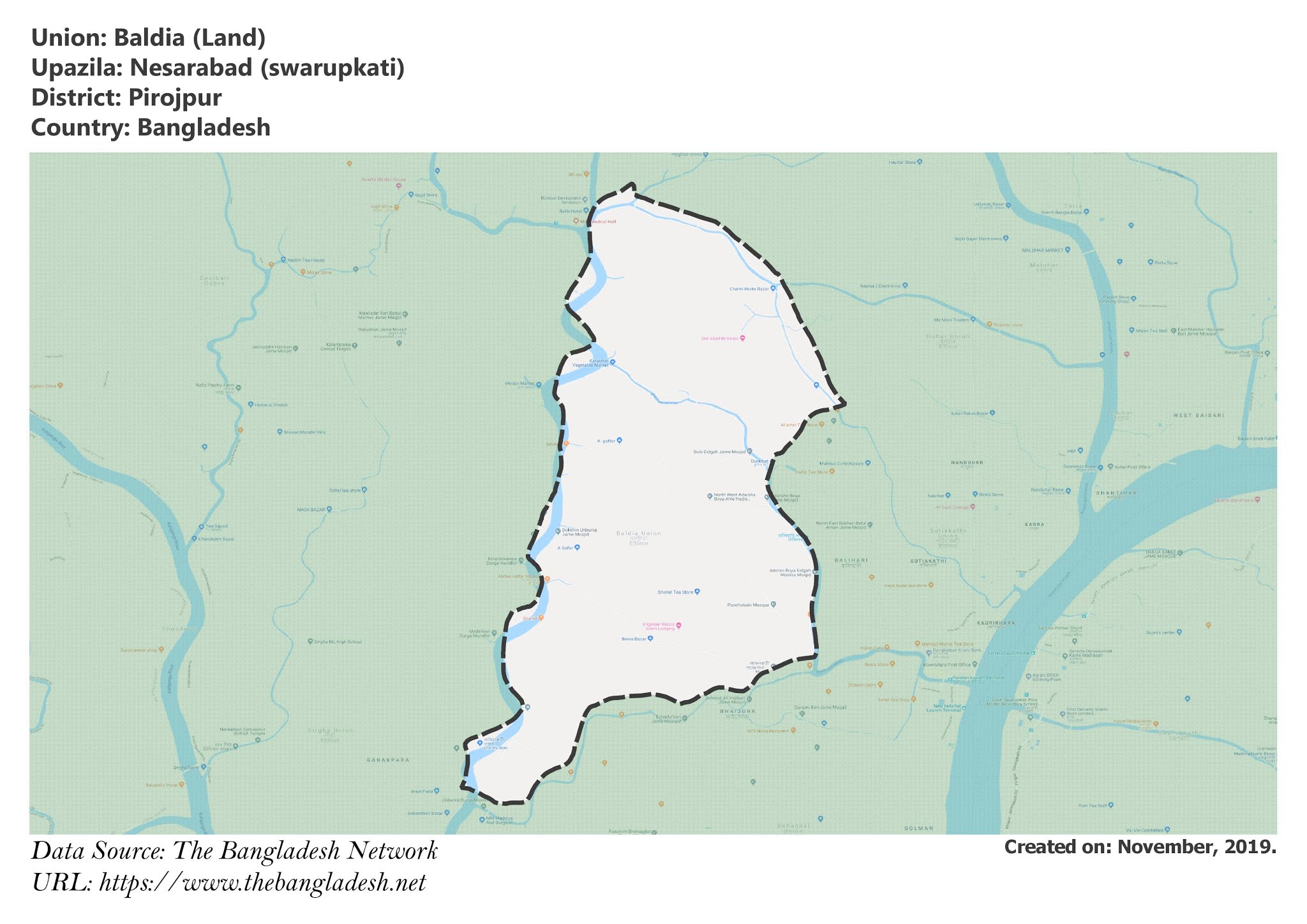
Map of Baldia of Nesarabad (swarupkati) Upazila.
Map Courtesy: The Bangladesh Network.
- Details
- Written by Mahamudul Hasan
Guarekha Union, Pirojpur
Guarekha is a union under Nesarabad (swarupkati) Upazila of Pirojpur District with a total area of 26.856 square kilometers. The total population of the union is 14,765 among them 7,465 are male and 7,300 are female.
Map of Guarekha of Pirojpur District.
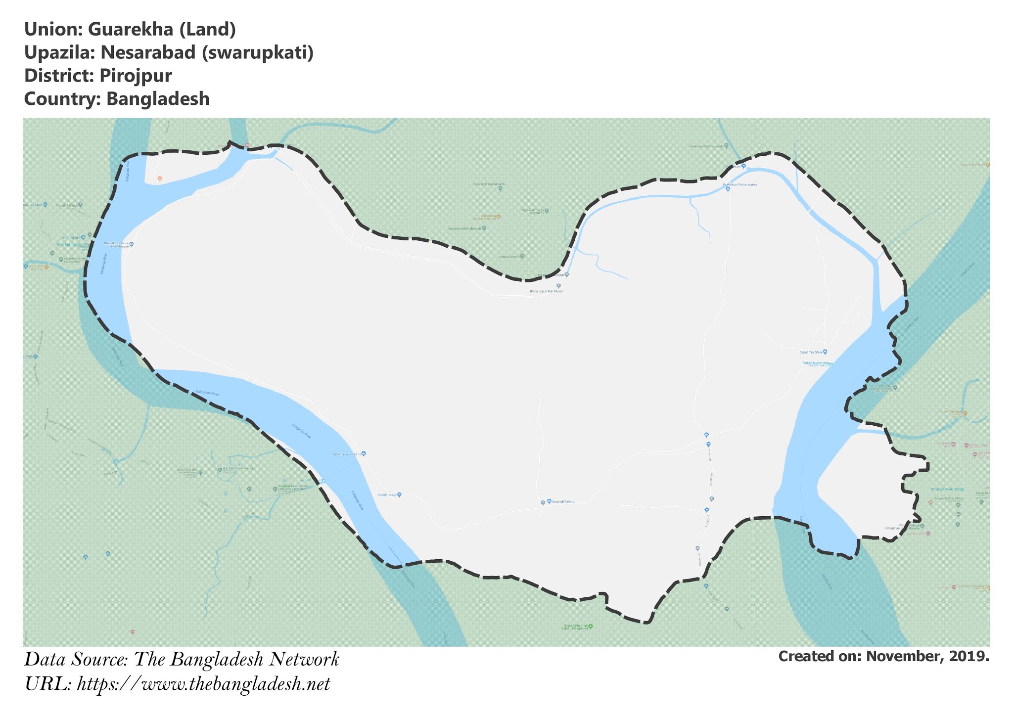
Map of Guarekha of Nesarabad (swarupkati) Upazila.
Map Courtesy: The Bangladesh Network.
- Details
- Written by Mahamudul Hasan
Daihari Union, Pirojpur
Daihari is a union under Nesarabad (swarupkati) Upazila of Pirojpur District with a total area of 15.934 square kilometers. The total population of the union is 10,801 among them 5,427 are male and 5,374 are female.
Map of Daihari of Pirojpur District.
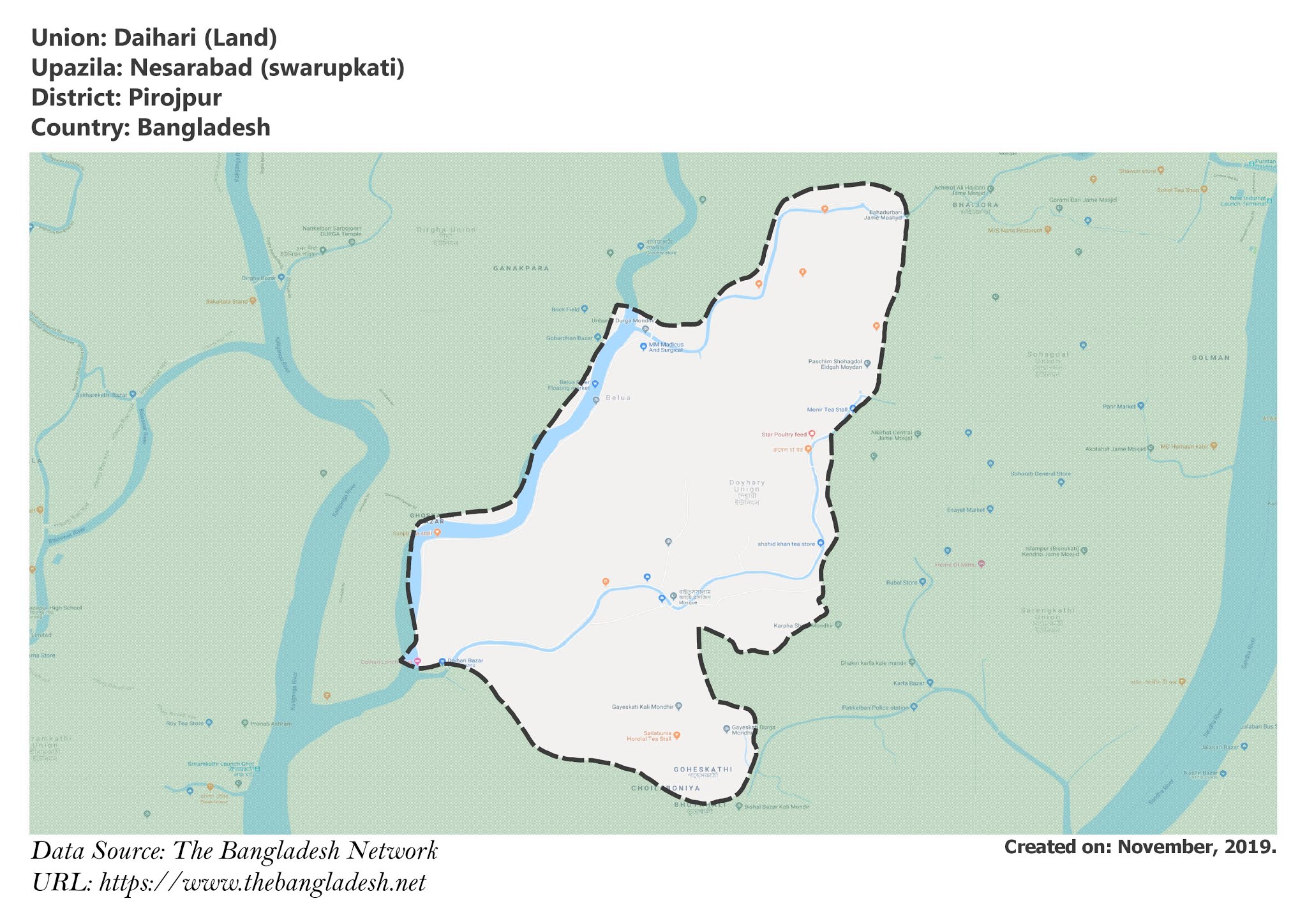
Map of Daihari of Nesarabad (swarupkati) Upazila.
Map Courtesy: The Bangladesh Network.
- Details
- Written by Mahamudul Hasan
Jalabari Union, Pirojpur
Jalabari is a union under Nesarabad (swarupkati) Upazila of Pirojpur District with a total area of 26.815 square kilometers. The total population of the union is 20,331 among them 10,268 are male and 10,063 are female.
Map of Jalabari of Pirojpur District.
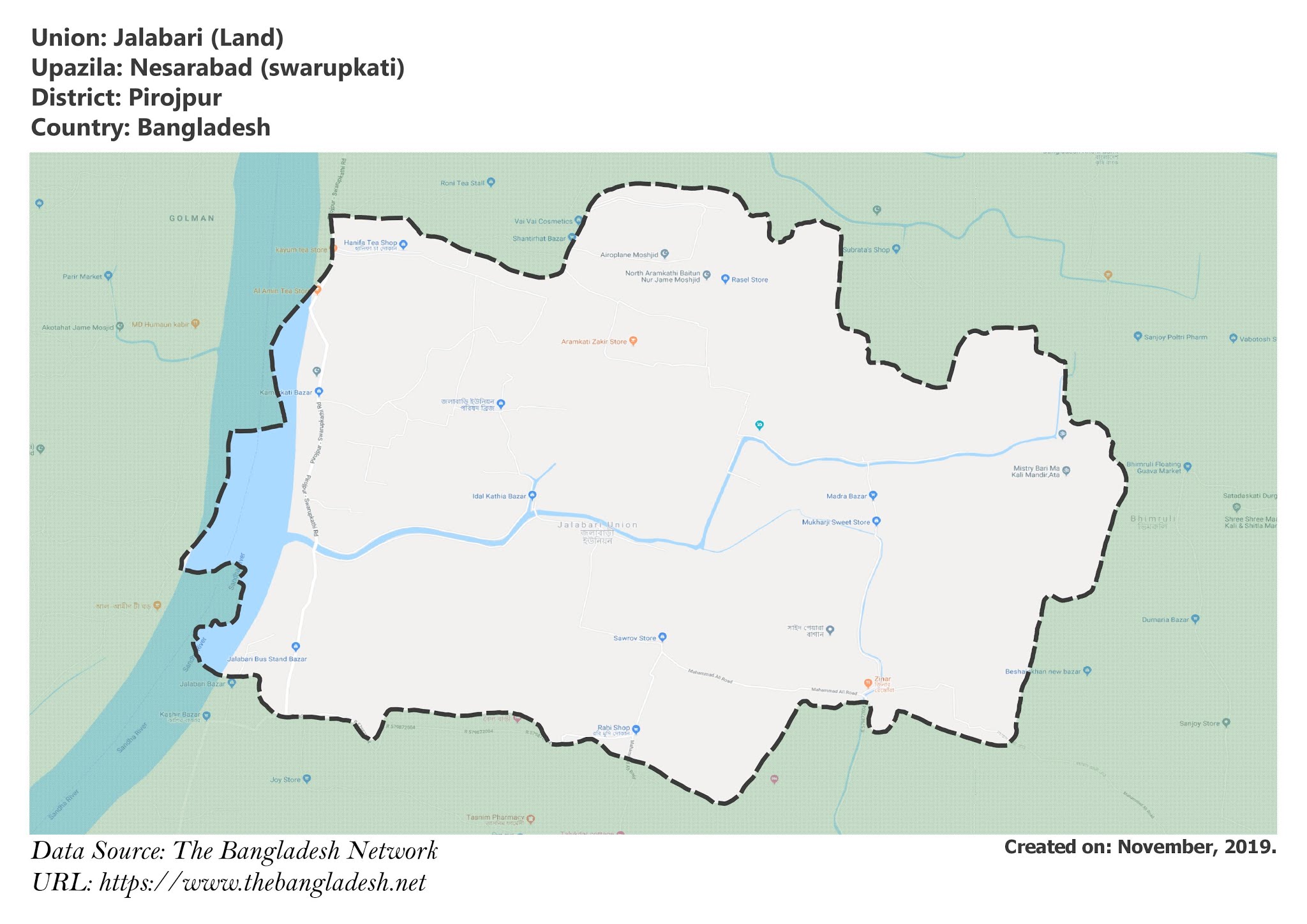
Map of Jalabari of Nesarabad (swarupkati) Upazila.
Map Courtesy: The Bangladesh Network.
- Details
- Written by Mahamudul Hasan
