Dirgha Union, Pirojpur
Dirgha is a union under Nazirpur Upazila of Pirojpur District with a total area of 24.604 square kilometers. The total population of the union is 18,476 among them 9,502 are male and 8,974 are female.
Map of Dirgha of Pirojpur District.
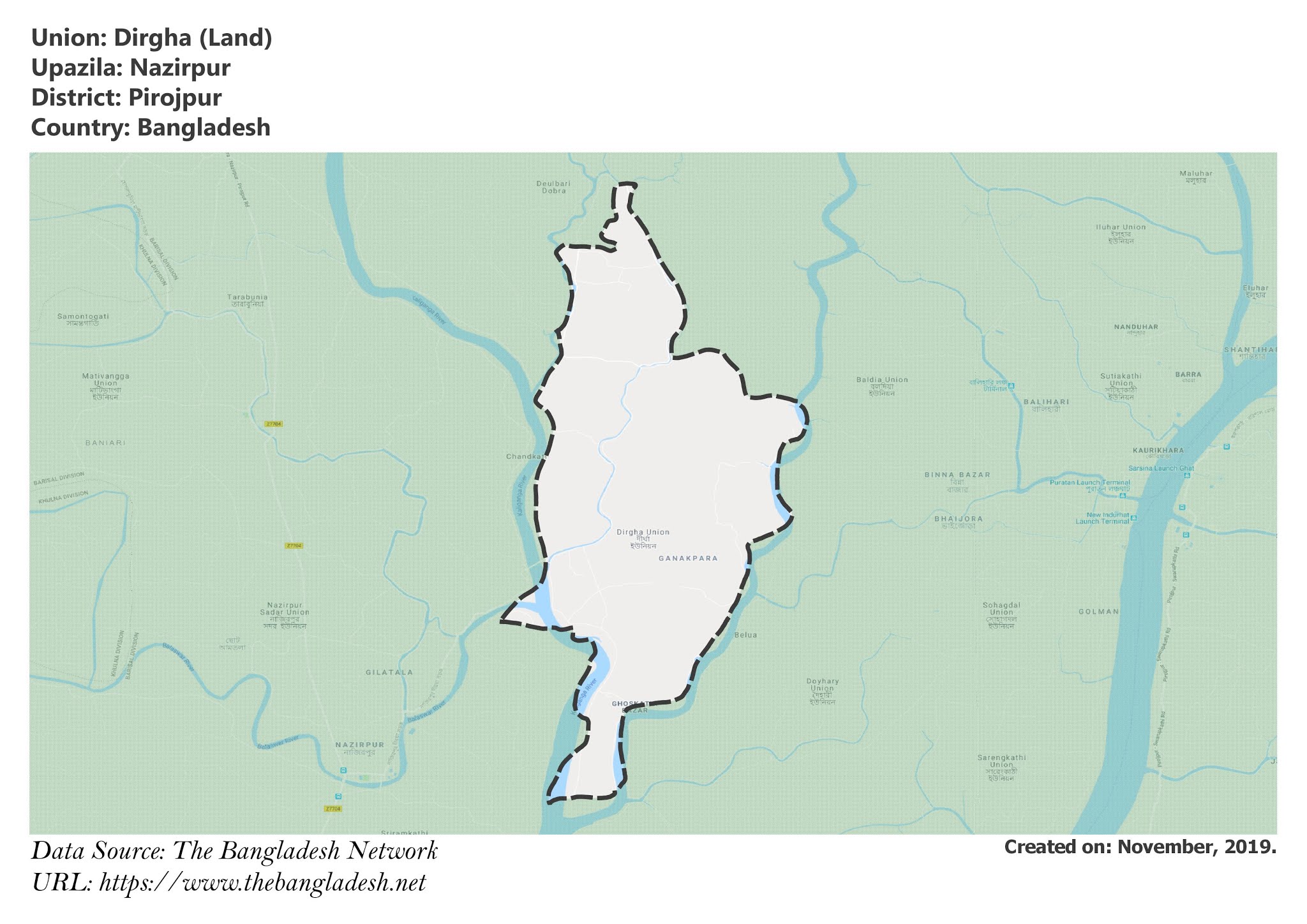
Map of Dirgha of Nazirpur Upazila.
Map Courtesy: The Bangladesh Network.
- Details
- Written by Mahamudul Hasan
Malikhali Union, Pirojpur
Malikhali is a union under Nazirpur Upazila of Pirojpur District with a total area of 30.931 square kilometers. The total population of the union is 21,686 among them 11,246 are male and 10,440 are female.
Map of Malikhali of Pirojpur District.
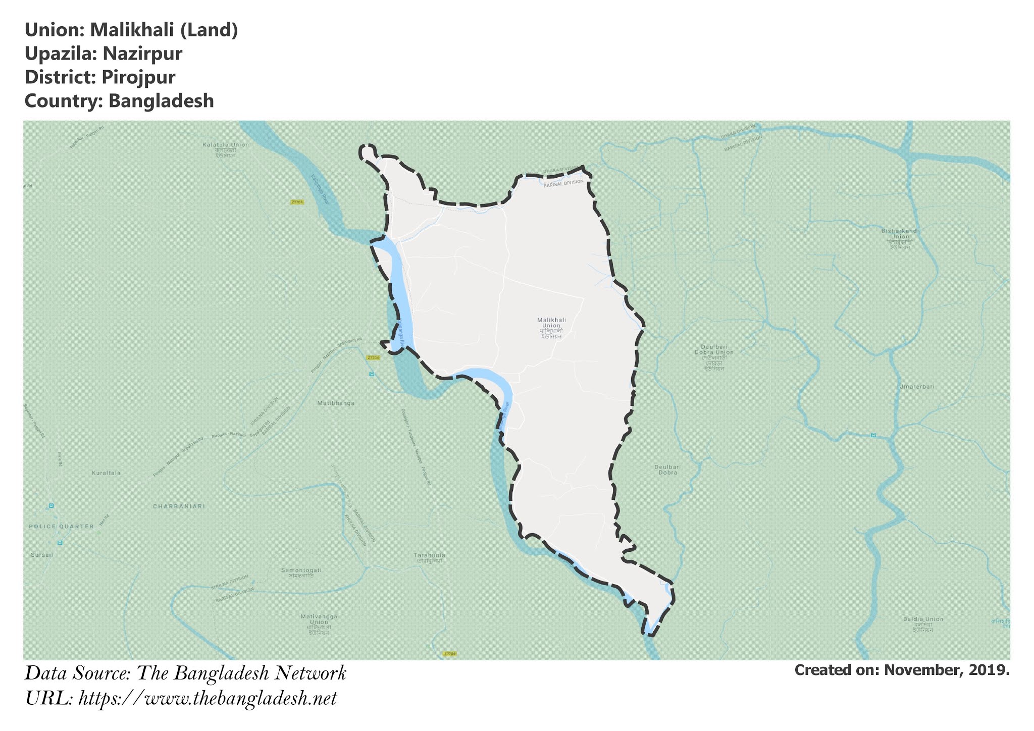
Map of Malikhali of Nazirpur Upazila.
Map Courtesy: The Bangladesh Network.
- Details
- Written by Mahamudul Hasan
Nazirpur Union, Pirojpur
Nazirpur is a union under Nazirpur Upazila of Pirojpur District with a total area of 21.274 square kilometers. The total population of the union is 18,348 among them 9,298 are male and 9,050 are female.
Map of Nazirpur of Pirojpur District.
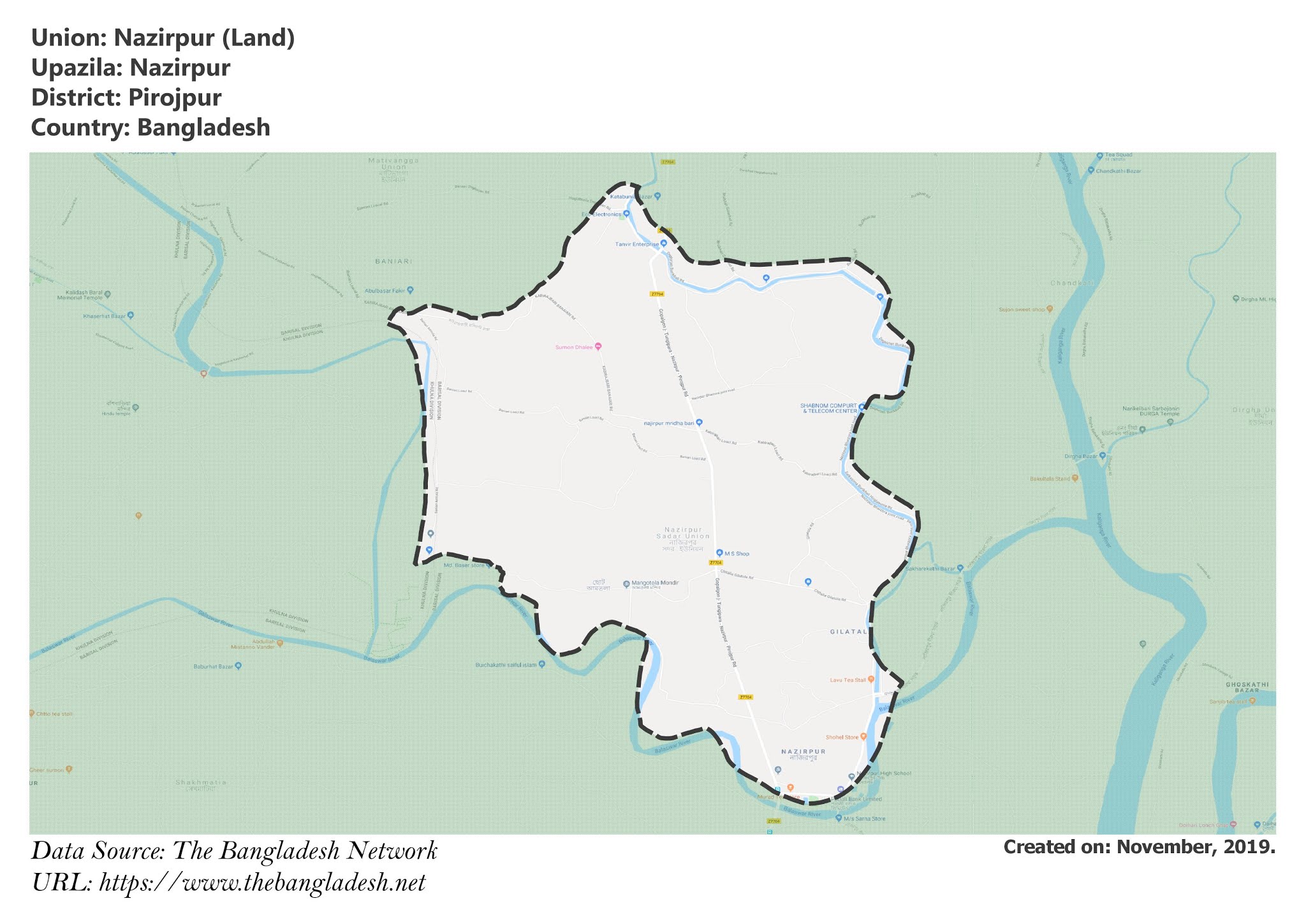
Map of Nazirpur of Nazirpur Upazila.
Map Courtesy: The Bangladesh Network.
- Details
- Written by Mahamudul Hasan
Matibhanga Union, Pirojpur
Matibhanga is a union under Nazirpur Upazila of Pirojpur District with a total area of 23.793 square kilometers. The total population of the union is 21,209 among them 10,708 are male and 10,501 are female.
Map of Matibhanga of Pirojpur District.
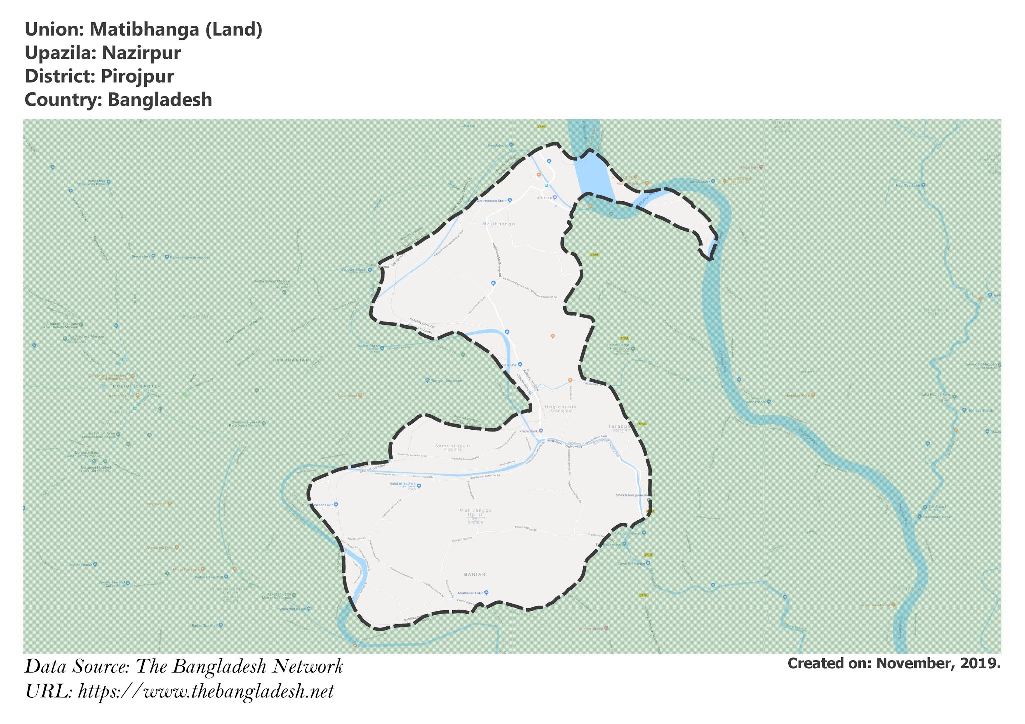
Map of Matibhanga of Nazirpur Upazila.
Map Courtesy: The Bangladesh Network.
- Details
- Written by Mahamudul Hasan
Purba Deulbaridobra Union, Pirojpur
Purba Deulbaridobra is a union under Nazirpur Upazila of Pirojpur District with a total area of 49.139 square kilometers. The total population of the union is 38,409 among them 19,696 are male and 18,713 are female.
Map of Purba Deulbaridobra of Pirojpur District.
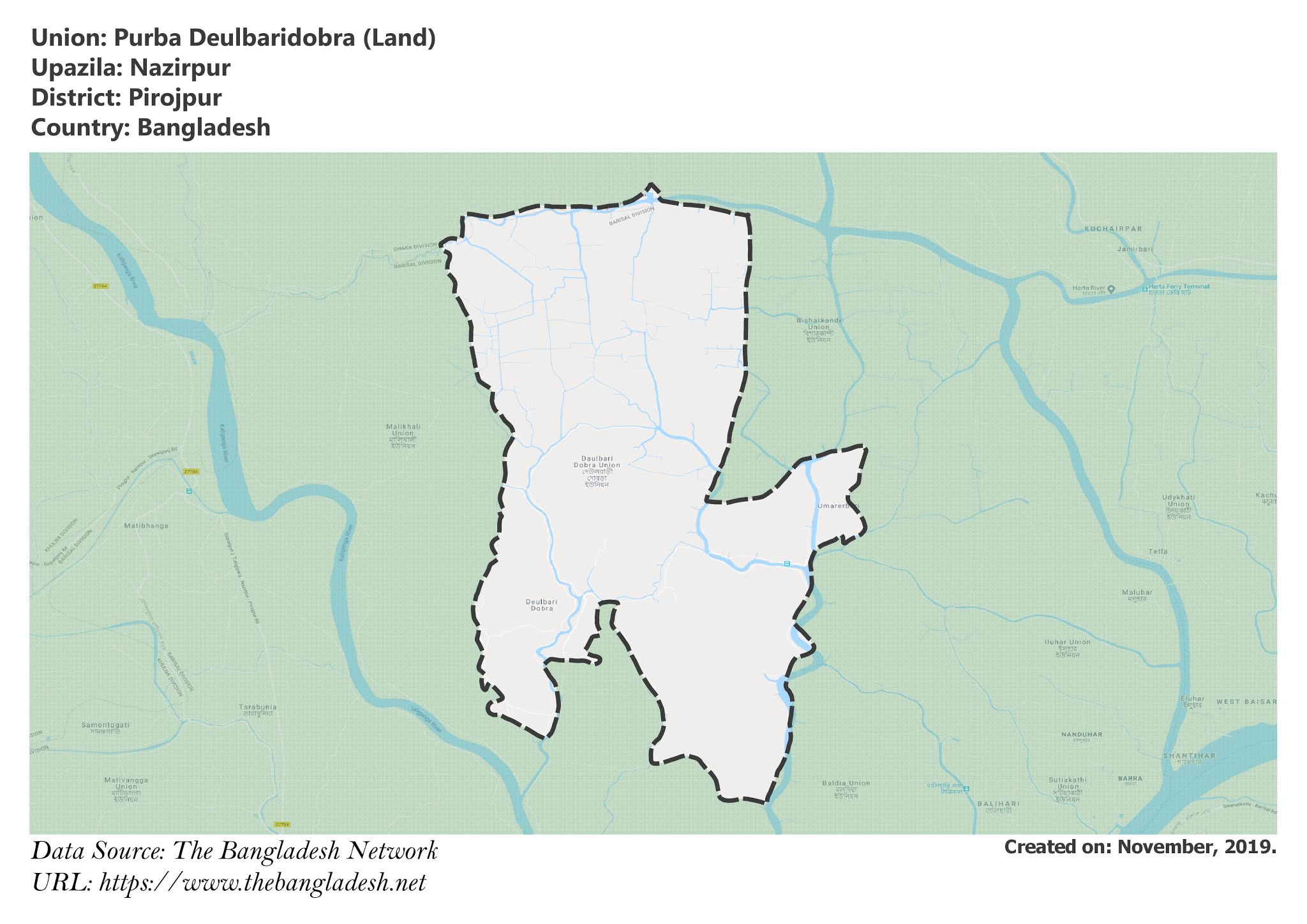
Map of Purba Deulbaridobra of Nazirpur Upazila.
Map Courtesy: The Bangladesh Network.
- Details
- Written by Mahamudul Hasan
