Basic Info
Basic Information
|
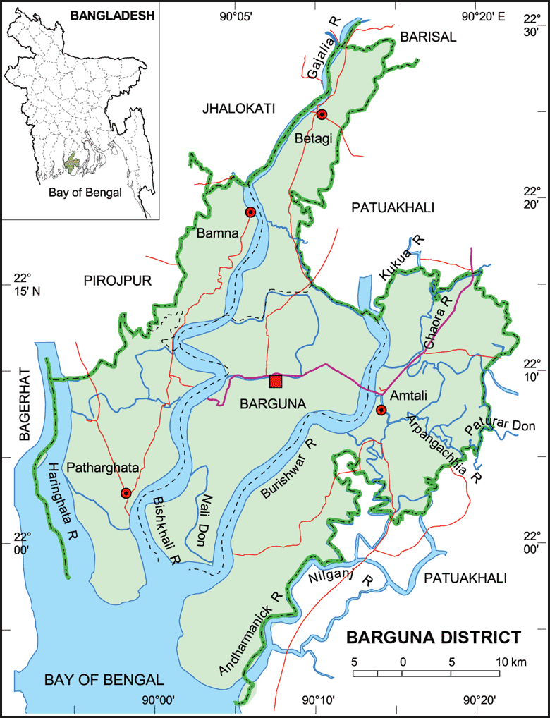
| Barguna District (Barisal division) a coastal district, with an area of 1,831.31 sq km, is bounded on the north by jhalokati, barisal, pirojpur and patuakhali districts, on the east by Patuakhali district, on the south by Patuakhali, the bay of bengal, on the west by pirojpur and bagerhat districts. Noted rivers are Payra, bishkhali and Baleshwar. Average annual temperature: maximum 33.3 oC and minimum 12.1 oC; annual rainfall 2506 mm (1997). |
At a Glance
|
| Area: |
1,831.31 Km2 |
| Upazila Road: |
465.07 Km |
| Union Road: |
677.97 Km |
| Village Road: |
1828.07 Km VA |
| 1747.71 Km VB |
| Population: |
|
| Density: |
|
| Literacy: |
|
| Upazilas: |
5 |
| Union: |
38 |
| Pourashavas: |
4 |
| Primary Schools: |
|
| High Schools: |
|
| Colleges: |
|